
If you’ve ever run a field operation with five different apps, three spreadsheets, two radios, and one overworked manager—congrats, you’ve met the digital paradox. In theory, technology should make fieldwork easier. But across Africa, too many organizations are overwhelmed by the very tools meant to simplify their jobs.
The issue isn’t just technical. It’s operational. The more apps we adopt to fix problems, the more problems we create. Fragmentation is now one of the biggest threats to effective field operations.
Tool Overload: When Technology Becomes the Problem
According to Oreoluwa Adebayo (founder, WeCollect), field teams in sectors like utilities, NGOs, agriculture, and humanitarian aid often rely on a messy stack of platforms:
- A mapping tool for location tracking
- A survey app for field data
- WhatsApp or email for task coordination
- A dashboard for analytics
- And still, paper backups and manual reconciliation
This isn’t digital transformation. It’s digital confusion.
A 2023 study by Tech for Development Africa found that 68% of field managers reported data delays, duplication, or outright loss due to using too many disconnected systems. In East Africa, one water utility project saw operational costs spike by 15% from 400 duplicated reports across three separate tools. That’s not progress—it’s paralysis.
Why This Happens
No one sets out to build chaos. What usually happens is this:
“We needed to track routes, so we added a GPS tool. Then we wanted better surveys, so we brought in another app. Now we can’t keep up,”
said a Field Lead at a Nigerian agribusiness.
Every new app is a quick fix. But no one’s fixing the bigger picture. And when those tools can’t talk to each other, the field becomes harder to manage, not easier.
The Real-World Impact
From telecom regulators to humanitarian responders, the cracks are showing:
- Field workers spend more time switching tools than doing the actual work.
- Teams operate in data silos. One app collects, another analyzes, but nothing syncs.
- Training becomes a burden. Multiple platforms mean multiple manuals and more frustration.
- Delays creep in. The right data, at the wrong time, becomes useless.
In a West African aid project, multiple agencies deployed different systems for logistics, beneficiary tracking, and surveys. The result? Duplicated efforts, conflicting records, and a delayed response when speed was critical.
What’s the Alternative?
Organizations don’t need more tools. They need better ones—platforms built for the real world, not just checklists.
GIS (Geographic Information Systems) is increasingly becoming central to solving this mess. Far from being just a mapping tool, GIS enables:
- Smarter planning with real-time geolocation
- Live field activity tracking
- Efficient task assignments and performance monitoring
- Offline-first access for poor connectivity areas
- Unified data that supports real-time decisions
The Nigerian Communications Commission (NCC), for instance, could improve oversight and reduce environmental risk by integrating GIS into its base station lifecycle, from planning to decommissioning.
One Platform. One Source of Truth.
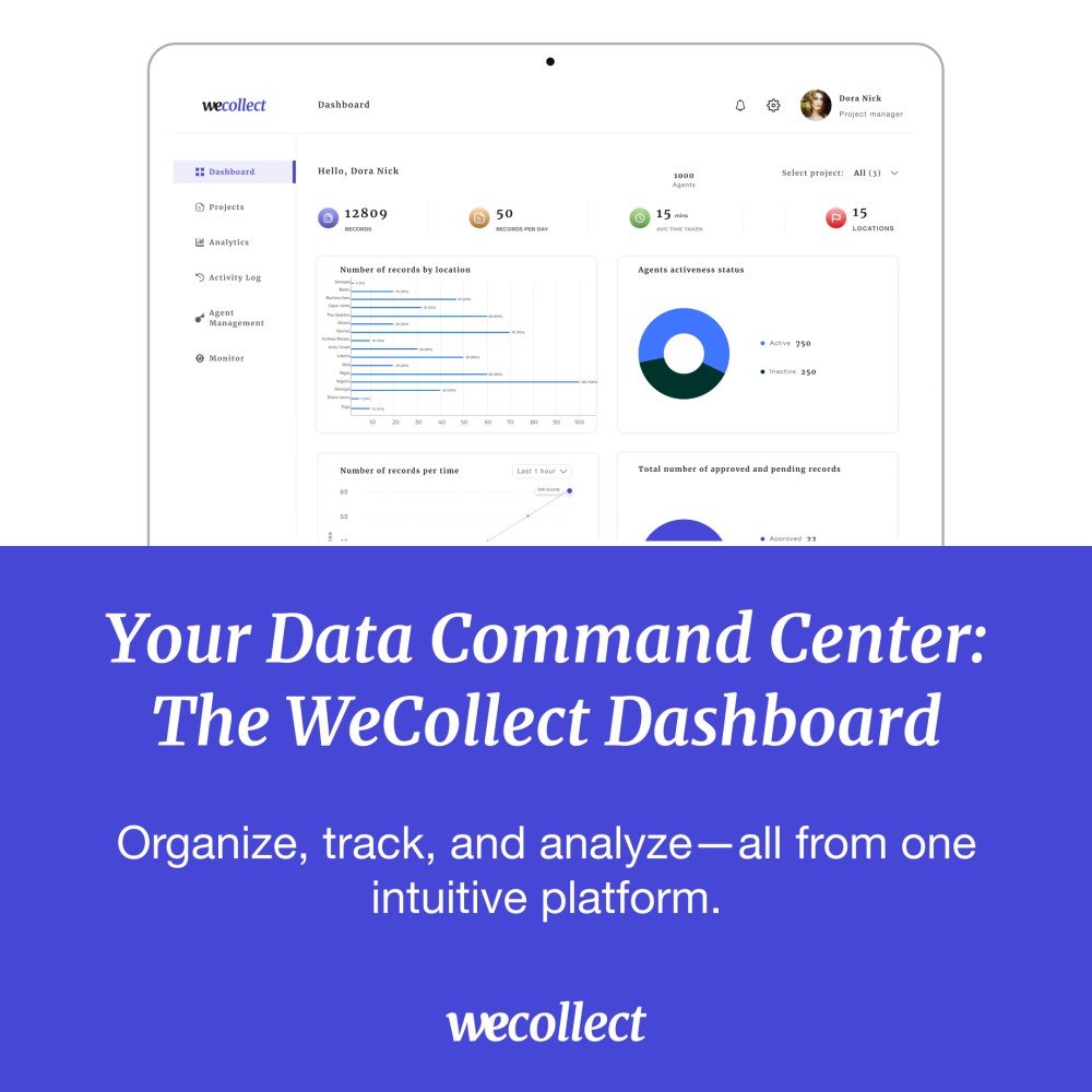
This is where WeCollect enters the picture, not as another tool, but as a complete system.
Built for African field realities, WeCollect brings together:
- GIS-integrated mobile data collection
- Real-time dashboards
- Route tracking
- Incident reporting
- Offline-first capability
- Easy-to-use forms
It’s one app. One workflow. One source of truth. And that’s what field teams need: less jumping between tabs, more doing the actual work.
So What’s Next?
If your team is drowning in disconnected tools, it’s time to stop digitizing dysfunction. Integrated platforms aren’t just more efficient—they save money, time, and decision-making energy.
Want to see how WeCollect works?
👉🏽 Start a free demo today at demo.wecollect.tech
👉🏽 Or schedule a walkthrough: oreoluwa@wecollect.tech
Let’s take field operations from chaos to clarity, one smart decision at a time.